In this webinar, hosted with Picterra, experts from Google, Unilever, and Picterra explored how emerging technologies such as Geospatial AI and satellite data can help businesses overcome compliance challenges and move from reactive sustainability reporting to proactive, data-driven oversight.
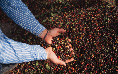
Sustainability claims are facing increasing scrutiny, with rising costs, data uncertainty and growing pressure on businesses to provide verifiable proof of their efforts. Supply chain blind spots, outdated data and manual processes leave sustainability teams struggling to confidently meet compliance requirements.
This webinar, hosted in partnership with Picterra, explored how emerging technologies such as Geospatial AI (GeoAI), remote sensing, and satellite data analytics can empower sustainability teams with trusted insights, enabling them to move from reactive reporting to proactive oversight.
Our panel of experts discussed:
- The key hurdles businesses face in achieving sustainability compliance
- Strategies for moving from outdated, manual processes to more scalable, data-driven solutions
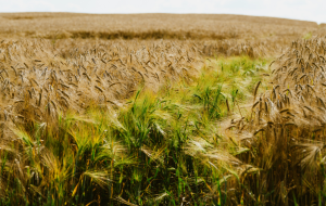
- An overview of Geospatial AI and how it is changing the landscape of supply chain transparency and monitoring
- The role of geospatial monitoring in identifying high-risk landscapes and improving compliance
- The future of AI in sustainability: opportunities, concerns and limitations
Panel:
- Alicia Sullivan, product manager – Earth Engine sustainability solutions, Google
- Pierrick Poulenas, CEO and Co-founder, Picterra
- Andrew Wilcox, associate director for sustainability – procurement strategy & insights, Unilever
The conversation was moderated by Ian Welsh, publishing director, Innovation Forum.
Want to keep the conversation going with Picterra? Click here to get in touch with the team and download Picterra’s new whitepaper ‘GeoAI for sustainability’. Click here to watch a video recording of the discussion
Click here to read a summary of the discussion
- Click here to view the questions asked during the webinar.
Other useful information:
- See Google Earth Engine Initiative to explore Google Cloud Partners and that can help build solutions
- Click here to see FAO’s digital public infrastructure “WHISP” (What’s in that plot?) that supports small and medium organisations to understand deforestation risk.
- Click here to see Forest Data Partnership’s annual commodity maps on Google Earth Engine
- Click to see Alicia Sullivan’s talk at Google Cloud NEXT that shows how layers from Forest Data Partnership and others can be used to understand deforestation risk with BigQuery.